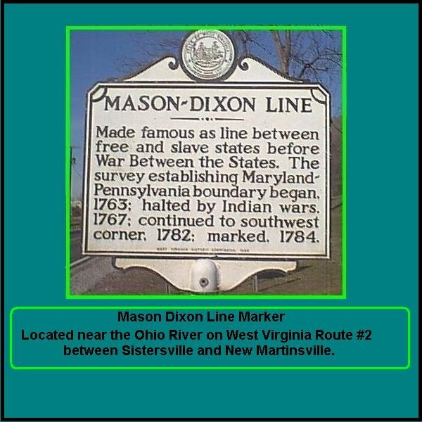
Originally the Mason-Dixon Survey, completed in 1767 during the English Colonial Period, established
an exact boundary between the lands of William Penn, Lord Proprietor of the Province of Pennsylvania, and those of Cecil Calvert,
the second Lord Baltimore, Proprietor of the Province of Maryland. By mere coincidence, over time the Mason-Dixon Survey
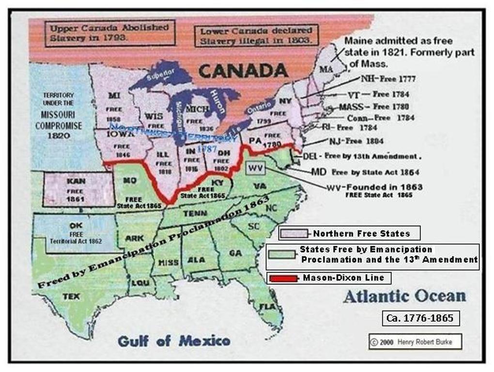
Line morphed into the Mason-Dixon Line which was the border between the States of the United States where the enslavement
of African Americans was legal and the States of the United States where the enslavement of African Americans was illegal.
The Mason-Dixon Survey was initiated in 1763, when Charles Mason and Jeremiah Dixon
landed the monumental task of resolving an 80-year property dispute. Mason was an astronomer employed by The Royal
Society in Greenwich, England. He had spent his time observing the stars and the moon, and establishing lunar tables that
could be used to determine longitude. Dixon was a surveyor from Cockfield in Durham County, England, and who had been educated
by John Bird, a renowned maker of high precision astronomical instruments.
Charles Mason and Jeremiah
Dixon left England and arrived at Philadelphia on the 15th day of November, 1763. They worked as a team for a total of 58
months plotting the boundary between the English Colonies of Pennsylvania and Maryland and extending the survey westward to include the boundary between Pennsylvania
and Virginia in what today is West Virginia.
Mason and Dixon at once
determined the latitude and longitude of the city of Philadelphia, the boundary began exactly 15 miles south of the southern
most tip of the city of Philadelphia . This was at the northeastern corner of Maryland, which was, the beginning of the parallel
of latitude that had previously been agreed upon as the boundary between the two provinces.
On the 17th day of June, 1765, the party reached the Susquehanna
River, where they received instructions to carry the line “as far as the provinces of Maryland and Pennsylvania are
settled and inhabited.” On the 27th of October 1765 they reached North Mountain. On the 4th day of June, 1766, they reached the summit of Little Alleghany. At that time, they were delayed
by Indian raiding on the frontier. Surveying was halted until Sir William Johnson negotiated a treaty with the Six Nations
in May, and on the 8th day of June. 1767, the surveyors resumed where they had left off the year before.
On the 14th of June, they
advanced as far as the summit of the Big Alleghany (Savage), where they were joined by an escort of Indians, with an interpreter,
who had been deputed by the chiefs of the Six Nations to accompany them. The Indians became restless and suspicious of so
much gazing into the heavens and marking on the ground. Some of the Indians and number of workers left the party with only
fifteen axe men. Mason and Dixon sent back to Fort Cumberland for more men, and kept on towards the setting sun.
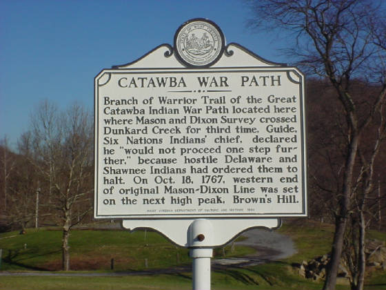
Finally they reached a point two hundred and forty-four miles from the Delaware River, where
they came upon an Indian warpath at Dunkard's Creek on the Pennsylvania line at present day Blacksville, West Virginia. Here
the Indians of the escort told the surveyors that it was the desire of the Six Nations that they should stop, so the party
returned to Philadelphia, reported to the commissioners under the deed of 1760, and were honorably discharged from their surveying
duties on the 26th day of December, 1767.